Taking Route in Color
Lesson Overview
Students will act as cartographers and use the internet to create print outs of world maps with routes showing family places or homelands. Printed maps will be the basis for original art work that students create. Students will also view the work of artists who use places to inform their map art. Students will use critical thinking to analyze these artists' work and reflect on their own art making process by writing their own artist's statement.
Big Idea
Art helps us look at our world in new and different ways
Essential Questions
What is migration?
What does geography have to do with it?
What places are related to migration of my family's ancestors?
How do artists use places to create art work?
Evidence of Understanding
Students will also collaborate in pairs or small groups to discuss and reflect on map art work of two artists by thinking critically to compare and analyze their works; producing a Venn diagram as evidence of their reflections. Creating a map artwork of their own will show students are able to look at the world in a new and different way, especially personal places related to them.
Instructional Learning Experience Number One
Students will act as cartographers as they view and create maps on the National Geographic website. They can use the family ancestry information from the previous lesson as a tool to plot the route places of their family migration, by drawing lines of travel on world maps. Print a copy of each student's map.
Formative Assessment: Check students' understanding in use of internet mapping website.
click here to open link for mapping website
Instructional Learning Experience Number Two
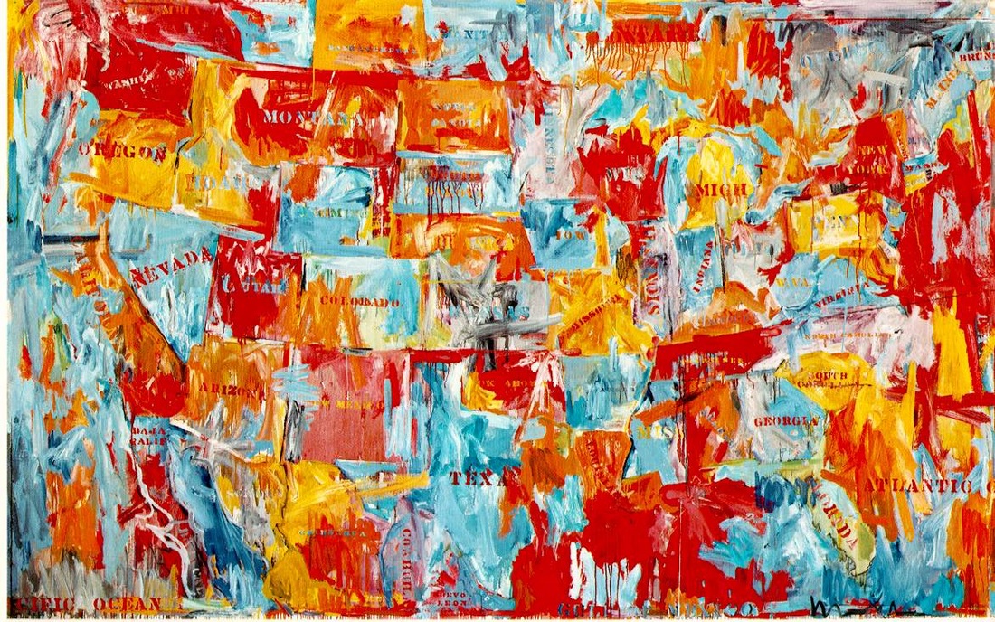
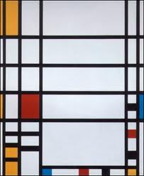
Students will look at examples of art work by Piet Mondrian and Jasper Johns. They will work in pairs or small groups and use a Venn diagram to analyze and reflect on the works and ask themselves how they might visually express familiar places they know using art. If possible, show students pictures or maps of the United States and Traflagar Square so they can see real images of the places depicted in the art works, too.
click here for more on Piet Mondrian
click here for more on Jasper Johns
Formative Assessment: If time permits students can share reflections on artists' work in larger groups or as part of a group discussion. Collect Venn diagrams to check for understanding and direction of student thinking.
Instructional Learning Experience Number Three
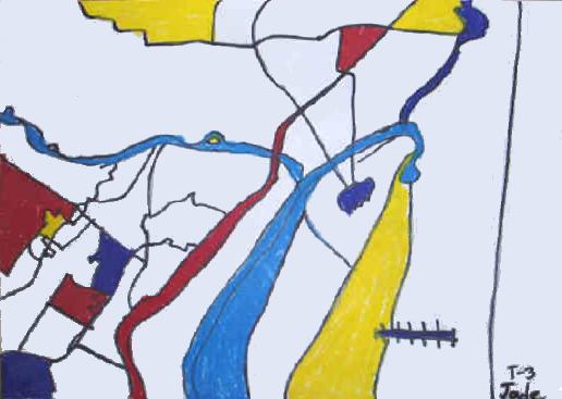
Students will use their printed map to create a map art work. By using an interesting section from this printed map as inspiration, they will copy main lines onto large drawing paper. In the style of Piet Mondrian, they will draw black lines with markers or oil pastels, and fill color in selected areas (staying true to the style of Piet Mondrian means that NO GREEN will be used, because it is on record that Mondrian hated green!). Students will write an artist's statement to explain their choices in the art making process.
Finished map art will be displayed in a class art walk. Peer comments will be recorded on a two column sheet which will log reflections to art work and statement.
Summative Assessment: Students will have a printed map with family migration routes drawn onto it. Students will create a map art in the style of Piet Mondrian, inspired by family migration, geographical maps and using oil pastels on paper. Students will also write an artist's statement to explain their art work. This statement will be used to explain how students made choices in their map art, specifically about how they see the world differently related to the places they show in their art.
Materials for this lesson:
Computers and printers to go online, trace and print out map routes
Drawing paper
Markers or oil pastels, or crayons
Samples of art works by Jasper Johns and Piet Mondrian
click here for more on Piet Mondrian
click here for more on Jasper Johns
Venn Diagram template
click here for link to Venn diagram template
| venn.pdf |
